The 606 walking trail in Chicago, formally known as the Bloomingdale Trail, is a fantastic spot to enjoy the outdoors. It gets its nickname from Chicago’s zip codes; the trail spans the 60647 and 60622 western neighborhoods. This guide explores everything you need to know about the 606 in Chicago, including how to get there, what to do in the park, and how to grab a bite to eat at Pequod’s Pizza.
What Is the 606?
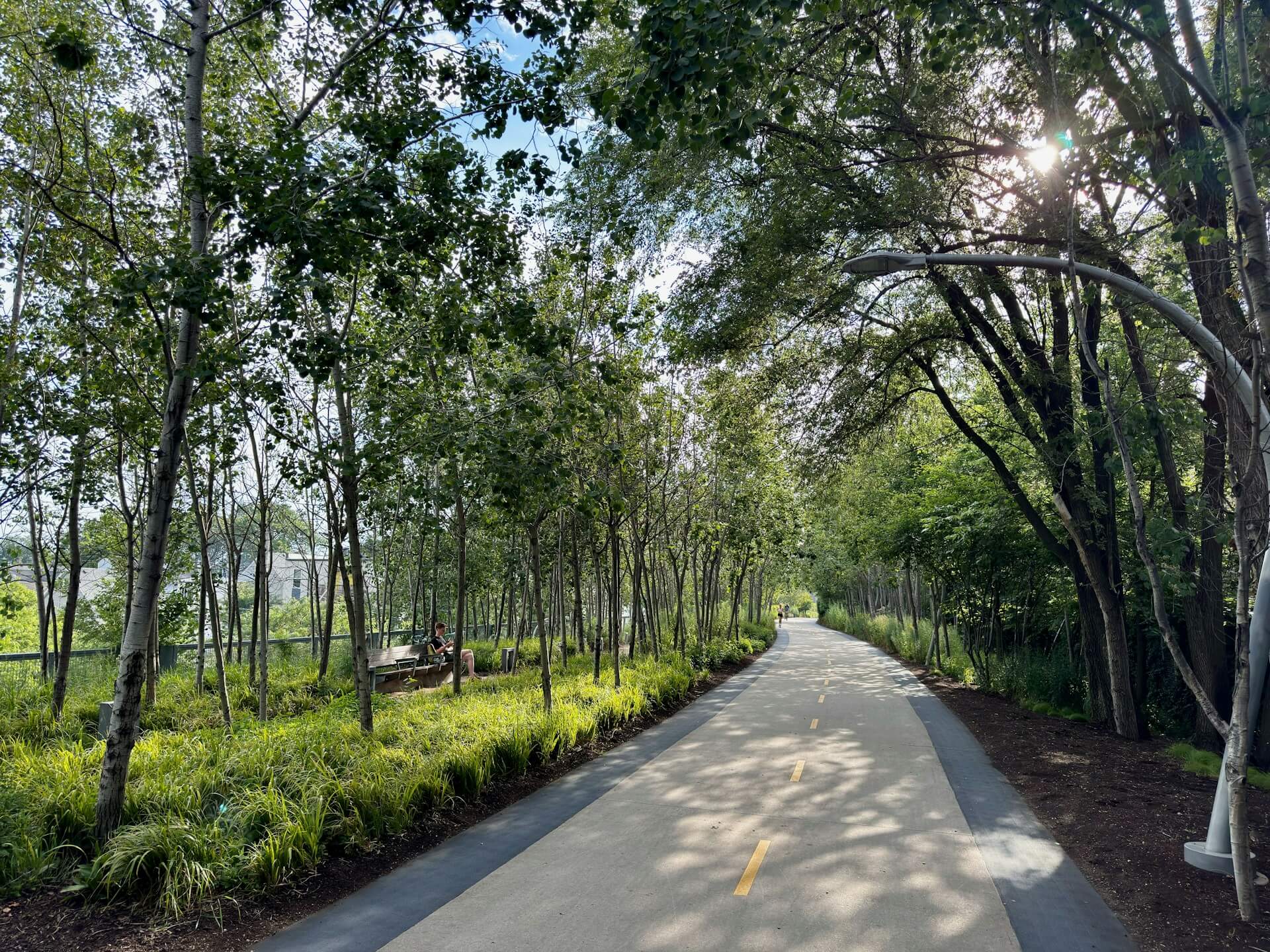
Situated on the northwest side of Chicago, the 606 is a recreational area known and loved for hiking and outdoorsy adventures. It includes 2.7 miles of elevated trails along an old railway line, part of a project to bring more green space to the city. This scenic and tree-lined elevated park in Chicago, with an elevation of about 20 feet above street level, is popular among cyclists and runners. But you don’t need to be a fitness junkie to appreciate it. Art installations and impressive designs scatter the route for families to stop at, stroll past, and enjoy.
The History of the 606
The Bloomingdale Trail, Chicago, follows an abandoned railway line route. The Chicago and Pacific Railroad Company first constructed the line in 1873. It formed part of a 36-mile subdivision from Chicago’s Halstead Street to Elgin, Illinois. It was integrated into the Chicago, Milwaukee, St. Paul, and Pacific Railroad — also known as the Milwaukee Road — with a 999-year lease in 1880 and a fee simple deed conveyance in 1900.
In the 1910s, the line was elevated those 20 feet into the air to make it safer for pedestrians. When the Milwaukee Road went bankrupt in 1986, the railway became part of the Soo Line Railroad, a subsidiary of the Canadian Pacific Railway. The company used the line for passenger and cargo trains until it abandoned it in 2001. After over 12 years of the railway lying unused, the city of Chicago bought the property right-of-way from the Canadian Pacific Railway in early 2013 and opened the 606 trail in 2015.
Exploring the 606: What To See and Do
There’s so much to enjoy along or near the 606 in Chicago.
Main Attractions of the 606
The trail’s main enticements depend on your interests and priorities. The 606’s most popular attractions include:
- Public parks: The 606 connects four street-level parks: Walsh Park, Churchill Park, Park 567, and Julia de Burgos Park. You’ll find playgrounds for kids, sports fields, and dog-friendly areas.
- Public art: The art installations are another favorite along the 606. You can find a range of permanent and temporary murals, sculptures, and interactive pieces, including the Graffiti Garden.
- A viewpoint: If you’re keen for a view, the Humboldt Overlook offers a beautiful view of a tree-lined street. You’ll find plenty of seating here for a rest.
- The Damen Arts Plaza: You’ll find various full-scale sculpture pieces in the plaza and plenty of bleachers to sit and people-watch.
- The Exelon Observatory: Climb the spiraling path to an elevated platform at the Exelon Observatory that marks the winter and summer solstices. This is an excellent spot to catch the sunset.
Activities To Enjoy on or Around the 606
There are many energetic or relaxed activities available on or near the 606. You can:
- Get active: The trail is a scenic route, which walkers, runners, skaters, and bikers often frequent.
- Have a picnic: There are four parks along the trail to enjoy a picnic. You can also stop at the Humboldt Overlook.
- Rent a bike or scooter: You can rent bikes and push scooters from Divvy stations in and around the area to explore the trail.
- Run a 5k: A family-friendly 5k trail run takes place annually along the route, usually around August or September.
- Stop for pizza: Visit us at Pequod’s Pizza, which is within a short walk of the trail. Enjoy our award-winning, high-quality, deep-dish pizza.
- Explore Walsh Park: Walsh Park is on the easternmost side of the trail. It offers a kids’ play area, basketball hoops, and a sandbox.
Practical Information for Navigating the 606: Location and Access Points
The 606 trail covers four Chicago neighborhoods, including Humboldt Park, Logan Square, Bucktown, and Wicker Park. It runs east to west, with Humboldt Park and Hermosa areas taking up the westernmost point and Bucktown and Wicker Park lying under the eastern end.
The easiest way to reach the various 606 entrances is by foot, bike, or the CTA Blue Line. The closest stations are Western and Damen. You can also reach the 606 via Metra commuter rail. Get off at the Healy stop on the Milwaukee District North Line near the western end or the Clybourn stop on the Union Pacific North and Northwest Lines near the eastern end.
There are 12 official Chicago 606 trail access points along the route, approximately every quarter of a mile, and 17 accessible ramps for those with disabilities:
- Western Trailhead: Ridgeway (3750W)/Lawndale (3700W)
- Drake: (3532W)
- Spaulding: (3350W)
- Julia de Burgos Park: Albany (3100W)/Whipple (3050W)
- Humboldt: (3000W)
- California: (2800W)
- Rockwell: (2600W)
- Western: (2400W)
- Park No. 567: Milwaukee/Leavitt (2200W)
- Churchill Field Park: Damen (2000W)
- Wood: (1800W)
- Walsh Park: (1632W)/Ashland (1600W)
Frequently Asked Questions
Here are some frequently asked questions about the 606 trail in Chicago.
How long is the 606?
The Bloomingdale Trail is 2.7 miles long and 10 feet wide.
When is it open?
It’s open from 6 a.m. to 11 p.m. daily.
Who can use it?
Anyone can use the 606. There are two-foot-wide running tracks or bike trails along both sides of the route. To be safe, stay on the right and pass on the left.
How much does it cost?
The trail is free to use and enjoy.
Stop for Lunch or Dinner at Pequod’s Pizza
After a day of adventure on the trail, you’ll likely have built up an appetite. Stop for a well-deserved meal at our Pequod’s Pizza restaurant, home to Chicago’s top-rated deep-dish pizza. Take advantage of our lunch special from Monday through Friday from 11 a.m. to 3 p.m. For more details or to reserve a table, please contact us.
Image by Shep McAllister is licensed with Unsplash License